How Snowflake’s AI-Powered Model Spots Building Flood Risks
Snowflake, the cloud-based AI data company, has joined forces with Ordnance Survey (OS) in identifying approximately one million undefended buildings in England at risk of flooding.
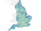
OS is the country’s official national mapping service, providing the latest geographical data that is relied on by the multitude, including the government.
The findings are laid out in the Intelligent Flood Readiness Model, leveraging OS’ detailed and up-to-date buildings and government data, alongside current Flood Risk Management Plans (FRMPs).
Synthesising critical data streams
The model brings together six different, critical data streams to synthesise them into a single, shared "structural intelligence" layer.
It cross-references OS’ building datasets with the Indices of Deprivation in England to identify where physical vulnerability, like building height and type, intersects with social risk. This is then layered against Environment Agency (EA) flood data, the EA’s Rivers and Sea defended and undefended flood risk extents and an AI-driven text analysis of more than 3,000 pages of statutory FRMP documents.
The results from the model aim to help policymakers better understand not just the likelihood of flooding in relatively small areas, but also which areas would suffer the most.
Highlighting the integration of data facilitated by AI, Fawad Qureshi, Global Field CTO at Snowflake, says: “Data is at the heart of making informed decisions. As this project shows, it’s rare that one body holds all the relevant data or that this data is in the same format.
“But we’re now in an era where technology can bring together the right people and the right data to collaborate on making better informed decisions.”
Period buildings and deprived areas at risk
As per the model’s analysis, as many as 1.2 million buildings in England are at risk of flooding and fall outside of existing flood protection systems. About 68% of these buildings also face high vulnerability to the after-effects of flooding due to its location in deprived areas lacking the resources and infrastructure that support quick recovery.
Much of this elevated flood risk owes to the fact that as much as 84% of these undefended buildings pre-date 2001, post which legislation has ensured flood risk to be factored into planning permissions.
Upon closer examination, the model points out that 15% of these premises date before 1919 and 23% from 1919 to 1959. This means they were potentially built before their location was identified as flood risk.
It also highlights the dynamic nature of England’s neighbourhoods, from high-rise buildings to newly-built flats and Victorian detached houses. The findings clearly illustrate the complex challenge facing flood planners, alongside the need for precise and granular data.
As Tim Chilton, Managing Geospatial Consultant at OS, notes, the aim of the collaboration is to “help local authorities better understand, plan for and manage floods”.
He adds: “By delivering geospatial intelligence difficult to derive manually, decision-makers can access data-driven, actionable insights – without the burden of analysing endless spreadsheets.”
Recommendations for policymakers
Among many challenges facing flood planners and policymakers is that the data tracking the ever-changing natural and built environment moves quickly.
FRMPs are only produced every six years for broad geographical areas and are currently informed by relatively high-level data. However, the make-up of this area and how flood water may impact properties varies widely and changes frequently.
AI-powered tools come into play to bridge the gap, bringing together multiple sources of rich, in-depth and regularly-updated data. In doing so, policymakers can shift from static plans to dynamic models and create digital twins to examine how buildings could be affected before flooding happens.
By identifying properties that are potentially newly-vulnerable, as geographic data is updated, they can help produce more tailored, cost-effective flood plans.
The model offers five key recommendations for policymakers to investigate to better address the risks that England faces from more frequent flooding:
- Use the ability of similar models to analyse more granular data to move from treating wide, geographic areas as homogenous to factoring in neighbourhood or individual building vulnerabilities.
- Understand where there are clusters of vulnerability, especially when these areas straddle arbitrary boundaries like local authorities or FRMP zones.
- Look at surface water infrastructure investment. With most properties at risk from surface water flooding, investment in unseen infrastructure, like better drainage, could pay dividends.
- Consider a vertical risk assessment, factoring the height of a building as well as their footprint and creating specific high-rise emergency protocols.
- Factor in social deprivation to plans, as this will influence how well an area can deal with and recover from the aftermath of flooding. Two areas could have very similar natural geography and buildings but very different levels of deprivation or wealth.

Dynamic planning
Looking ahead, policymakers can utilise the latest, highly-granular data to produce a structural intelligence layer using AI rather than relying on hindsight, static maps and fragmented databases.
Fawad concludes: “It’s not the final answer, but it can inform the next question and help offer more protection to some of our most vulnerable neighbourhoods before the first drop of rain falls.”
By layering mapping, flood risk and social deprivation data, the model is a step forward in helping identify recommendations to protect communities with precision and confidence in a dynamic built environment.